|
The Planning Department collects and analyzes
demographic, physical, social, and economic data
regarding the City of Miami. All figures
are based on the 2000 U.S. Census.
To view additional
Miami Census information, click here.
|
|
Population Density
[click on thumbnail image for map] |
|
|
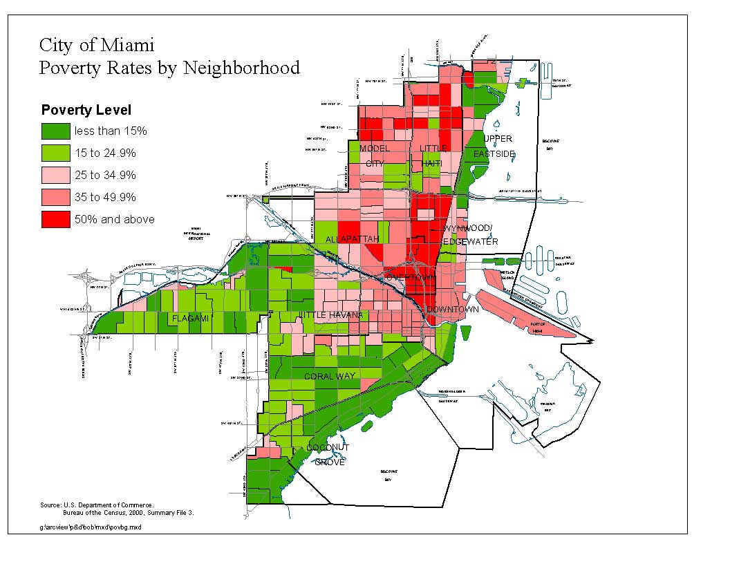
Poverty Rates
[click on thumbnail image for map] |
|
|
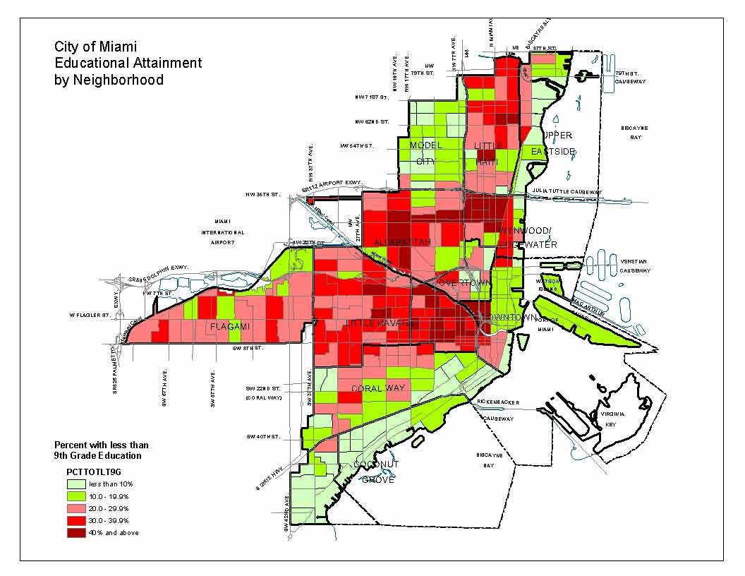
Educational Attainment
[click on thumbnail image for map] |
|
|
Median Household Income
[click on thumbnail image for map] |
|
|
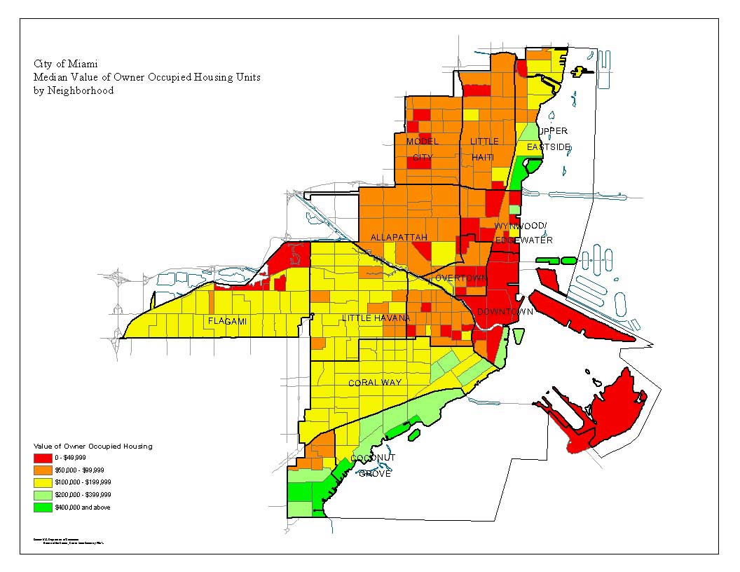
Median Value of Owner-Occupied Housing
[click on thumbnail image for map] |
|
|
Percent Owner Occupied Housing
[click on thumbnail image for map] |
|
|
Percent of Residents Foreign Born
[click on thumbnail image for map] |
|
|
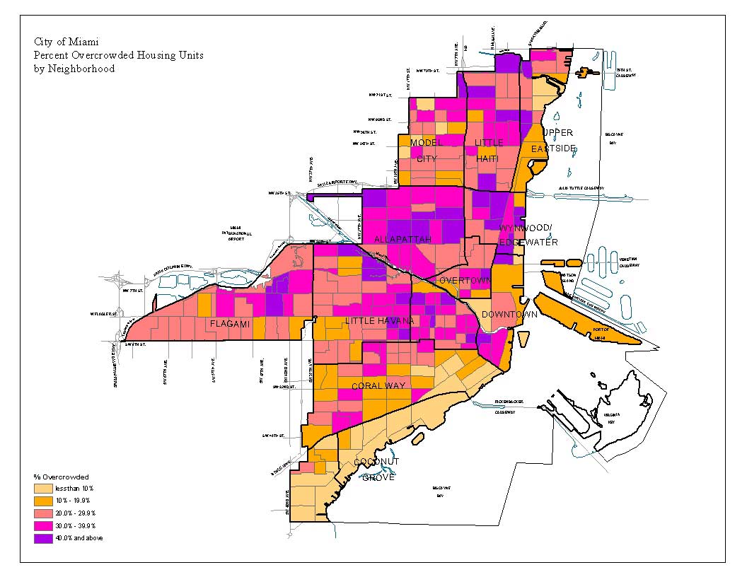
Percent of Overcrowded Housing Units
[click on thumbnail image for map] |
|
|
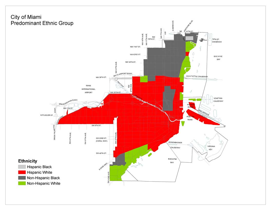
Predominant Ethnic Group
[click on thumbnail image for map] |
All documents are in Adobe .pdf format.
Adobe Reader is required to view these
documents.
If you do not have Adobe Reader, it can be
downloaded for free at the following link:
|